Toronto’s First Immigrant Hub: How the Ward Helped Shaped the City We Know Today

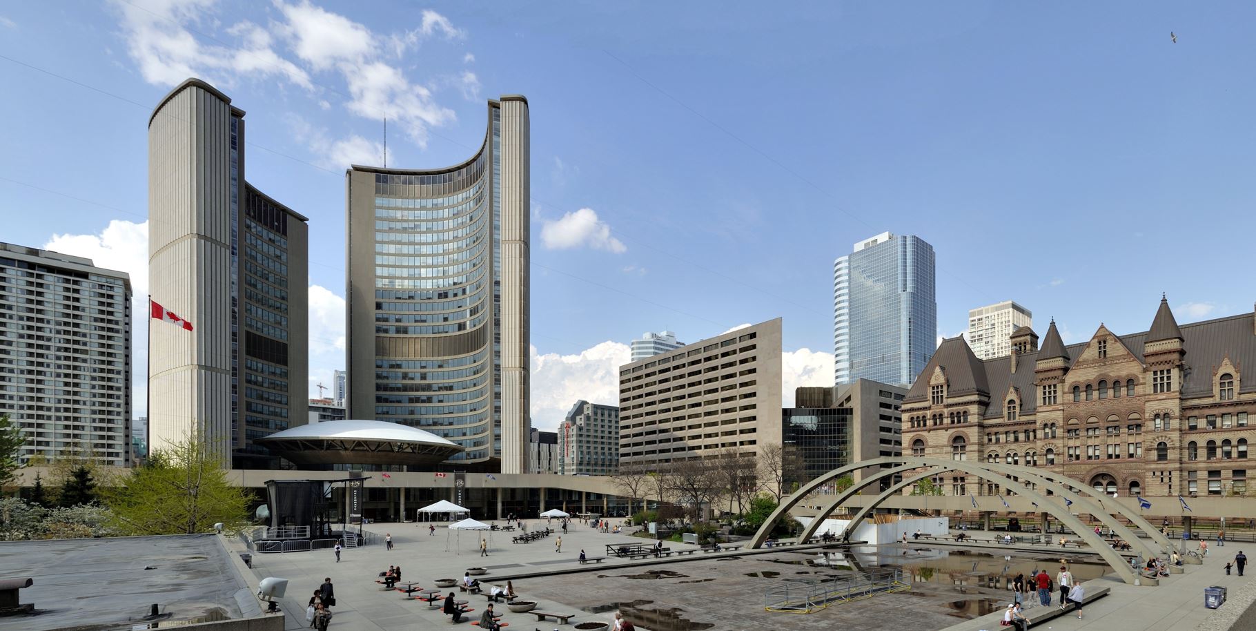
Before Nathan Phillips Square and Toronto City Hall, this part of downtown Toronto was home to one of the city’s first immigrant neighbourhoods—The Ward. Officially known as St. John’s Ward, it was a densely populated area where newcomers from America, Europe, China, and beyond—settled in search of opportunity.
As Toronto grew, The Ward was systematically dismantled, and today, little remains of the original community. Much of its history has since been forgotten with the passing of time, though some photographs and written accounts still exist for those who seek it. One of the most revealing historical records we have is land surveys—detailed plans that mapped the streets, homes, and businesses of The Ward. These surveys preserve critical evidence of the Ward, a historic neighborhood that laid the foundation for the city's rich cultural diversity.
What the Surveys Tell Us About the Ward
Looking at historic surveys, you can see the density and complexity of The Ward’s layout—a tightly packed grid of boarding houses, market stalls, synagogues, laundries, and community spaces. These same surveys also reveal the harsh realities of overcrowded living conditions that many immigrant communities endured as they worked to establish new lives in the city.
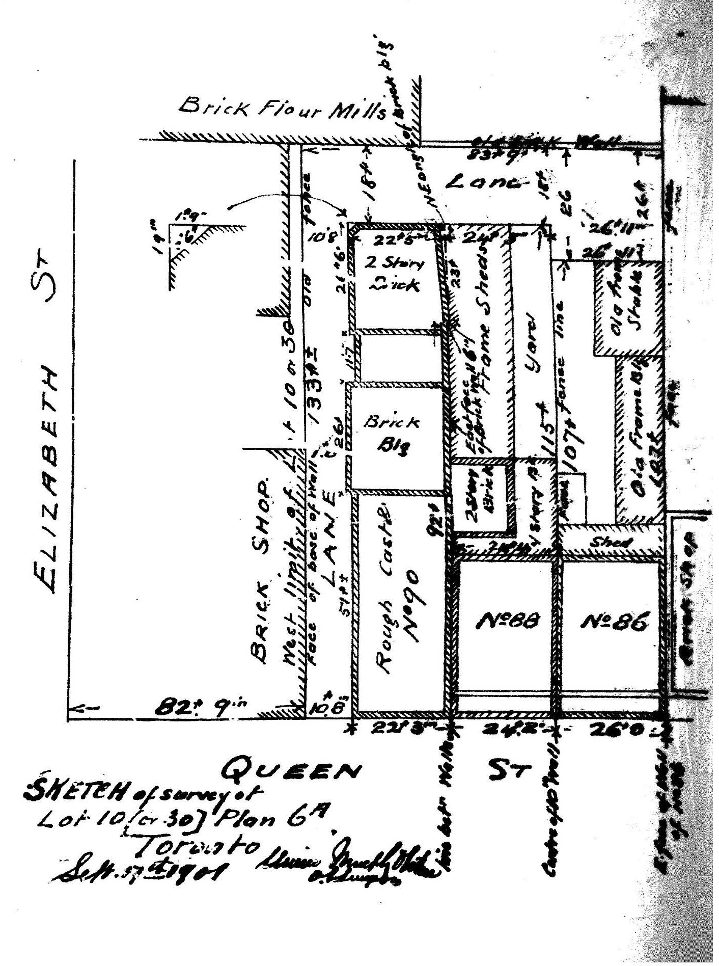 |
This survey from 1901 illustrates a section of The Ward in the late 19th and early 20th centuries.
|
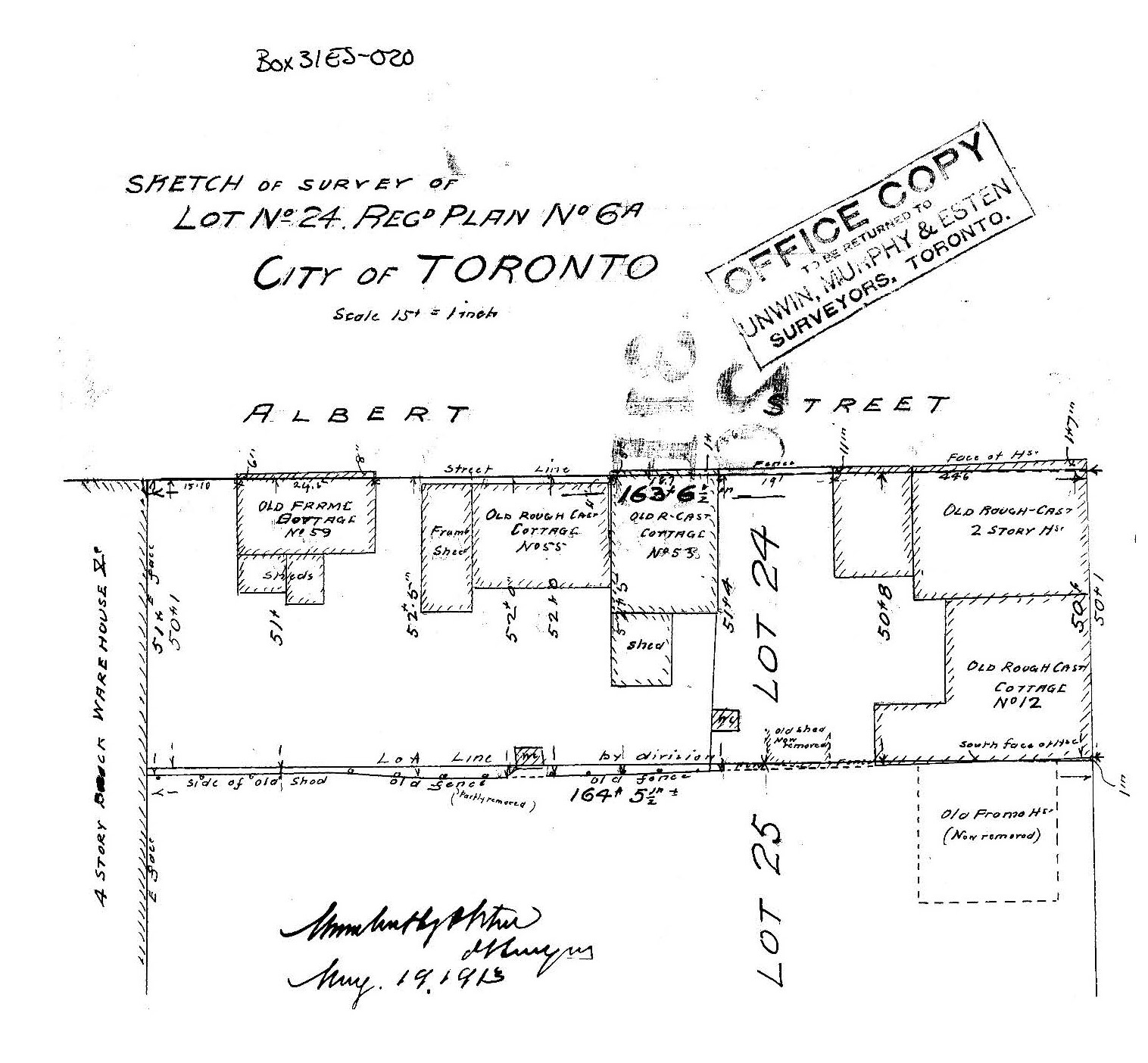 |
This 1913 Sketch of Survey provides a detailed snapshot of an area along Alberta Street in The Ward. The presence of multiple “old frame” and “rough-cast cottages” would suggest that this is a working-class neighbourhood. The survey also depicts narrow lot lines and mixed-use spaces including sheds and warehouses.
|
The Erasure of The Ward and What Remains Today
By the 1950s, much of The Ward had been demolished to make way for large-scale projects, including Nathan Philips Square and Toronto City Hall (1965). The expropriation and clearance of The Ward would have also been recorded in survey documents, marking the transition from working-class housing to government and corporate development.
As The Ward was gradually dismantled due to urban redevelopment, many of the immigrant communities that once thrived there found new places to settle across Toronto. Rather than fading away, they adapted and built new, lasting cultural hubs that continue to shape the city's identity today. The Italian community flourished in what is now Little Italy, Chinese immigrants established a strong presence along Spadina Avenue, and Jewish families relocated to Kensington Market and further north along Bathurst Street.
These neighbourhoods, which remain vibrant and culturally rich, are direct legacies of the resilience and determination of the early settlers of The Ward. Their histories serve as a reminder that Toronto’s strength lies in its diversity.
1. Ward History. (n.d.). The Ward: Toronto’s Lost Neighbourhood. Retrieved from http://wardhistory.ca/
2. TVO. (2020, December 3). How a forgotten Toronto neighbourhood is finding its place in history. Retrieved from https://www.tvo.org/article/how-a-forgotten-toronto-neighbourhood-is-finding-its-place-in-history
3. City of Toronto. (n.d.). The Black community in St. John’s Ward. Retrieved from https://www.toronto.ca/explore-enjoy/history-art-culture/black-history-month/the-black-community-in-st-johns-ward/
4. BlogTO. (2012, June 12). A brief history of The Ward, Toronto’s notorious slum. Retrieved from https://www.blogto.com/city/2012/06/a_brief_history_of_the_ward_torontos_notorious_slum/
Images:
5. Taxiarchos228. (2012). Toronto - ON - Rathaus und Nathan Phillips Square [Photograph]. Wikimedia Commons. https://upload.wikimedia.org/wikipedia/commons/6/61/Toronto_-ON-_Rathaus_und_Nathan_Phillips_Square.jpg
6. Toronto History. (2012, June 8). Old City Hall, Bay & Queen Sts., Toronto, 1920 [Photograph]. Flickr. https://www.flickr.com/photos/torontohistory/7374728042/


Protect Your Boundaries Inc. is a licensed member of the Association of Ontario Land Surveyors, and is entitled to provide cadastral surveying services to the public of the Province of Ontario in accordance with the provisions of the Surveyors Act R.S.O. 1990, Chapter S29.