How to Read a Survey Plan
Learn how to read a Survey Plan with our comprehensive guide. You’ll be able to identify key elements, find boundary lines, and analyze a survey plan.
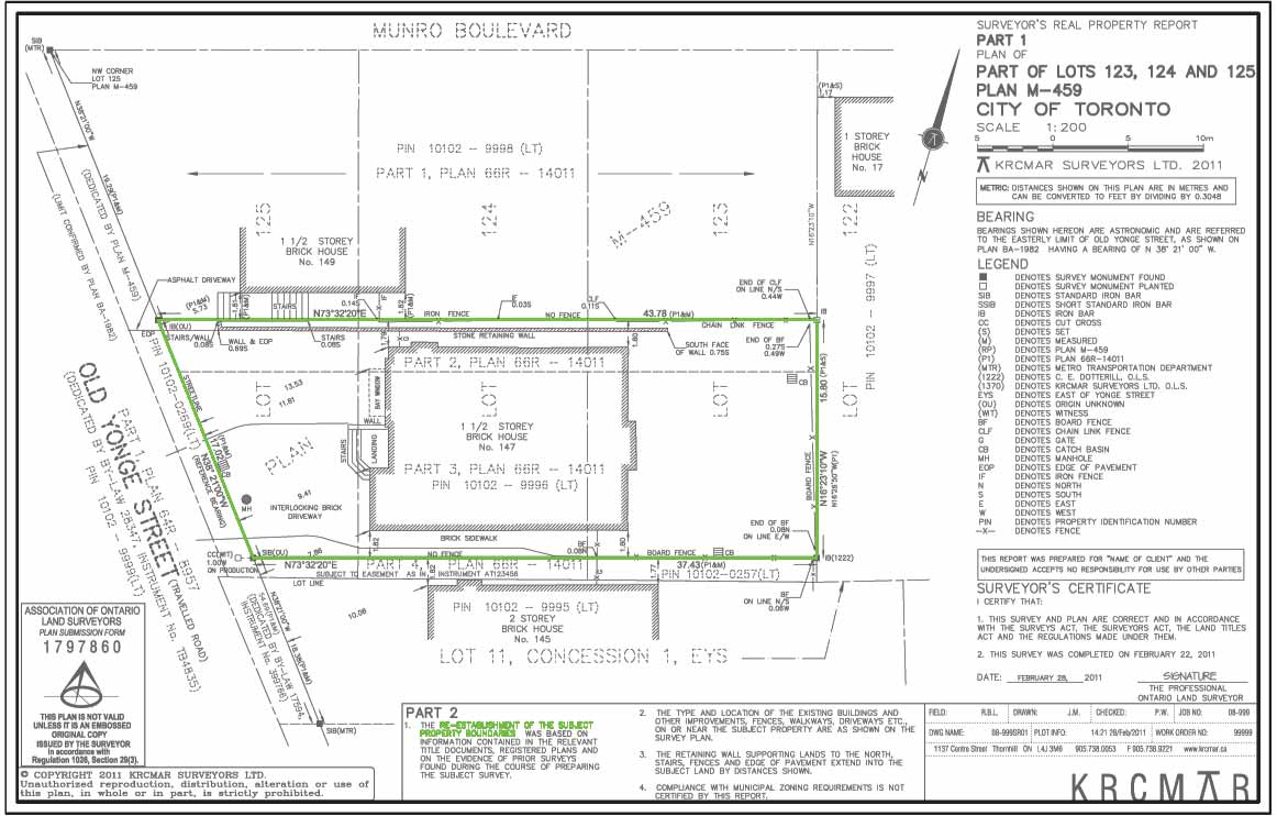
Survey plans are prepared by professional land surveyors, who identify and record features and measurements that contribute to the definition of a property.
Your land survey plan may look daunting at first glance, but understanding it is very important. We’ll help you understand the basics of a survey plan and how to use it.
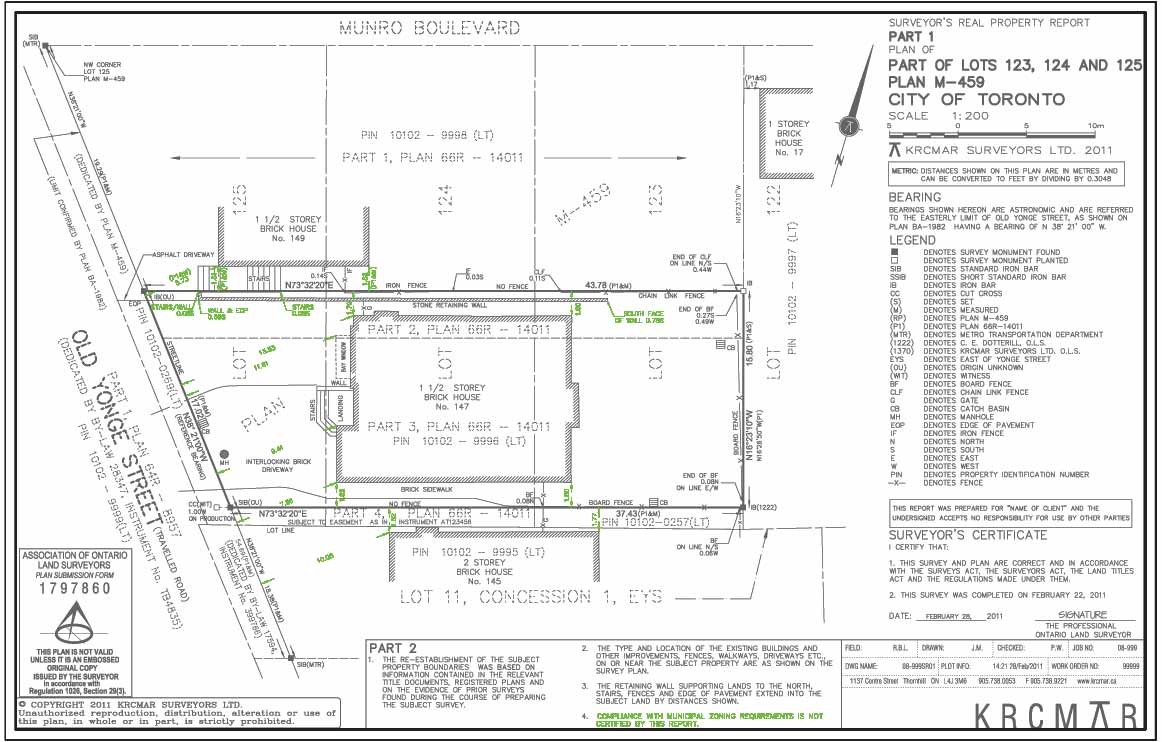
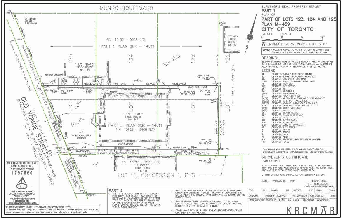
(M)-Measure Between Corners
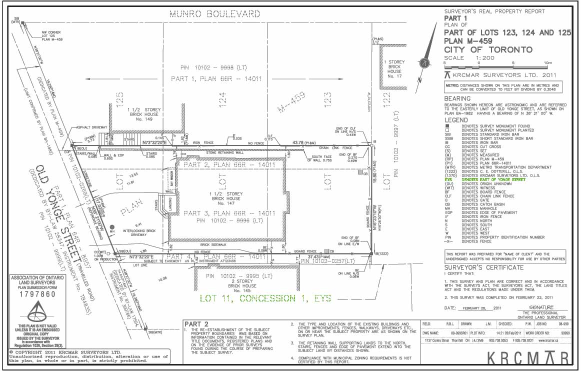
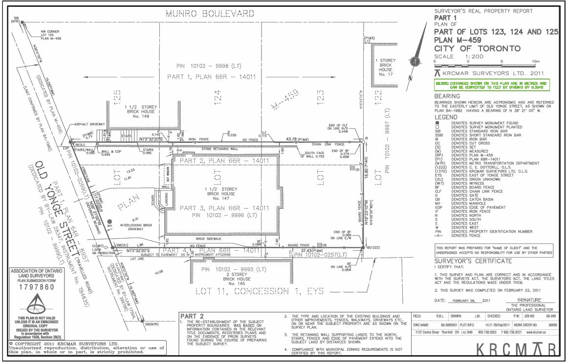
(M) - confirms what is already known by measuring the distance or direction.
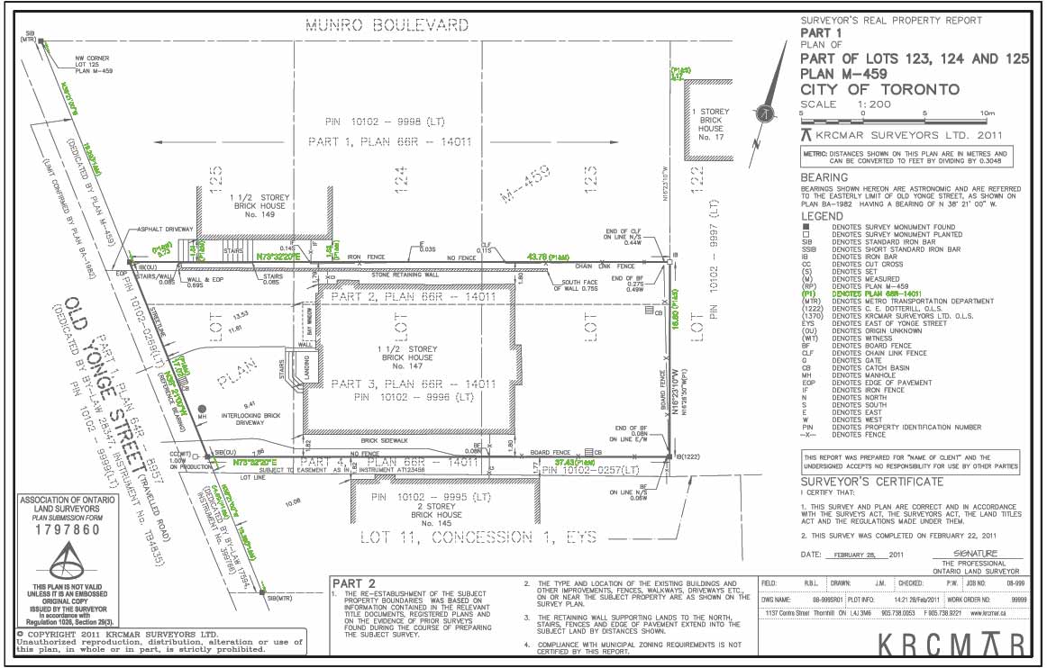
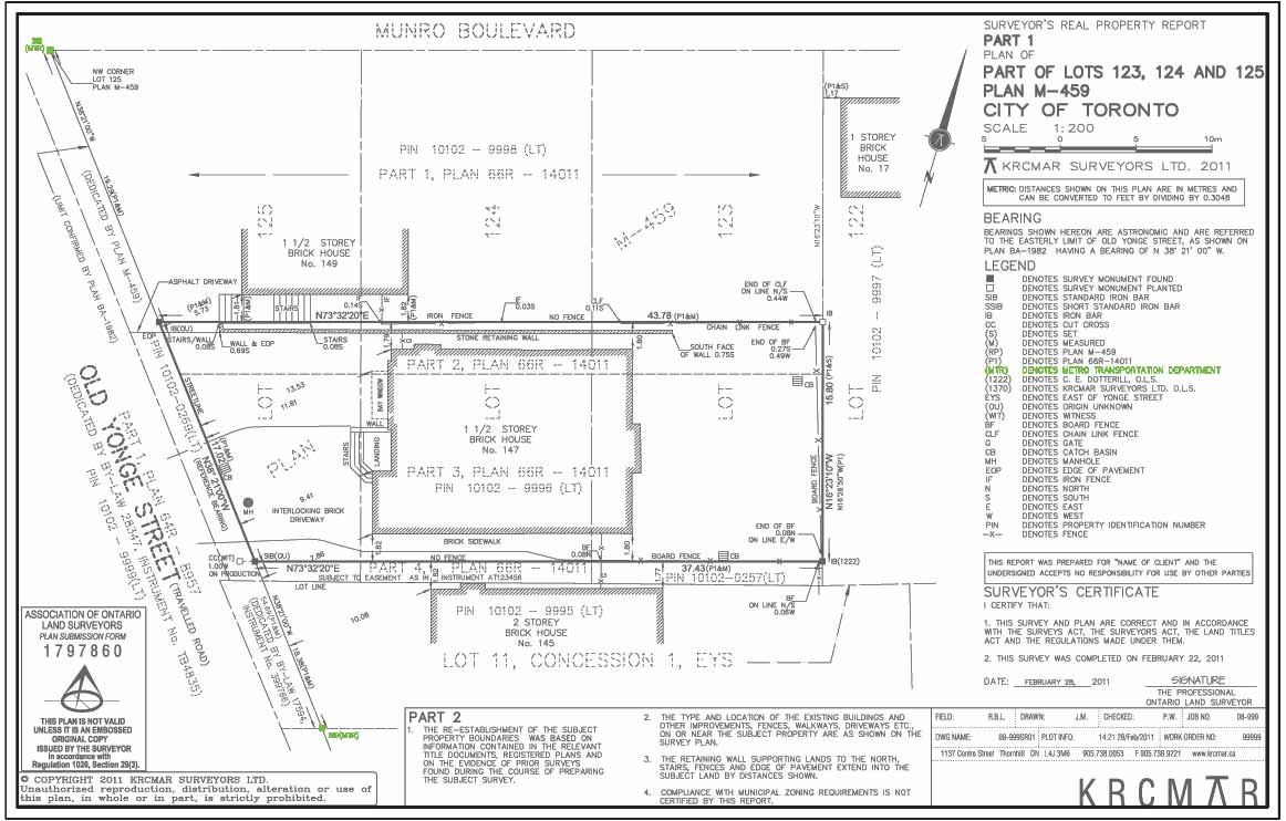
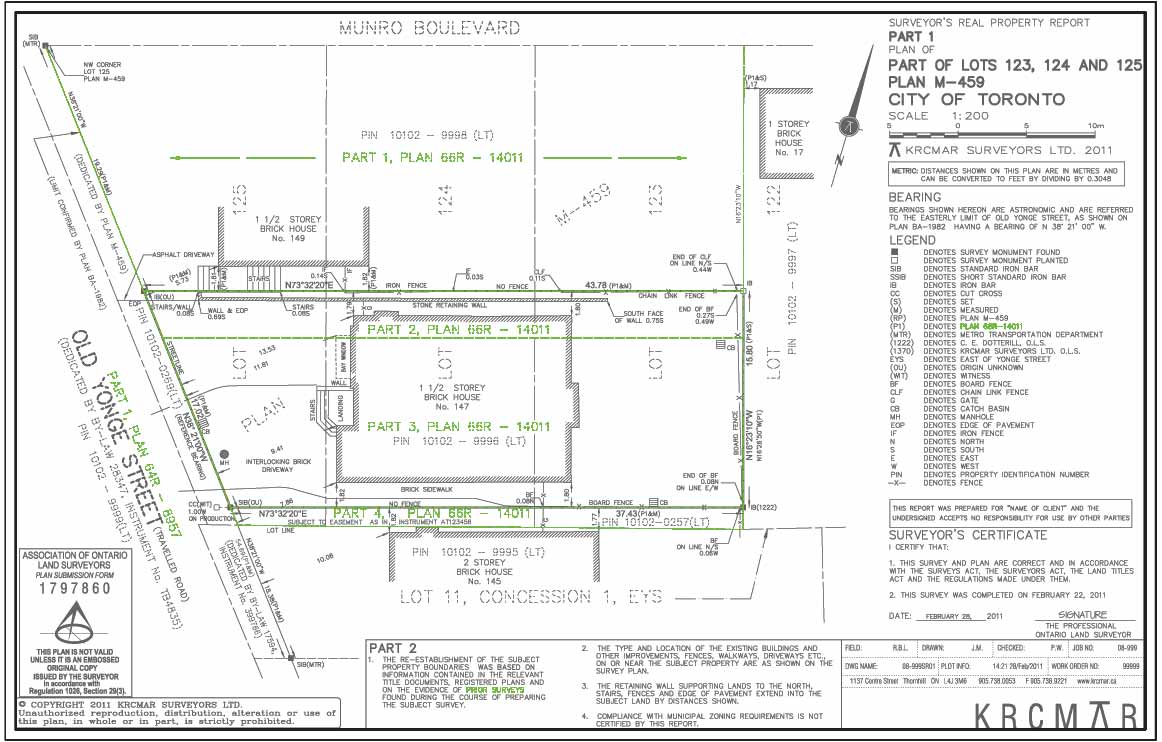
(MTR) Metro Toronto Roads
“ Metro Toronto Roads and Traffic Department". Forerunner of the City of Toronto Survey and Mapping Division.

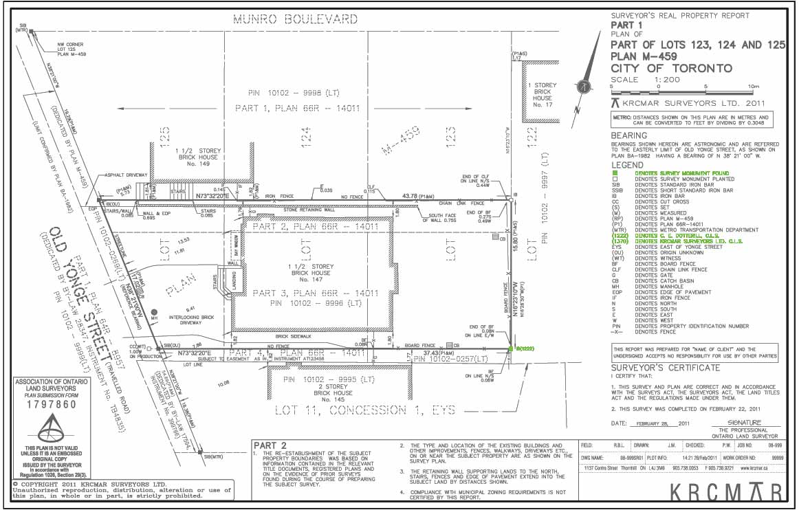
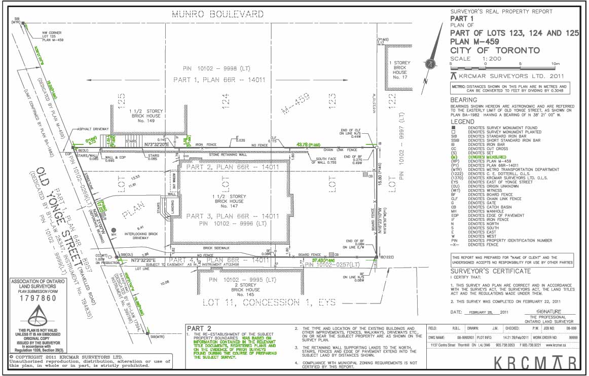
(1222) - The Surveyor's Bar
Identification number of the land surveying firm responsible for placing the monument.
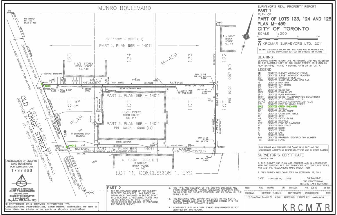
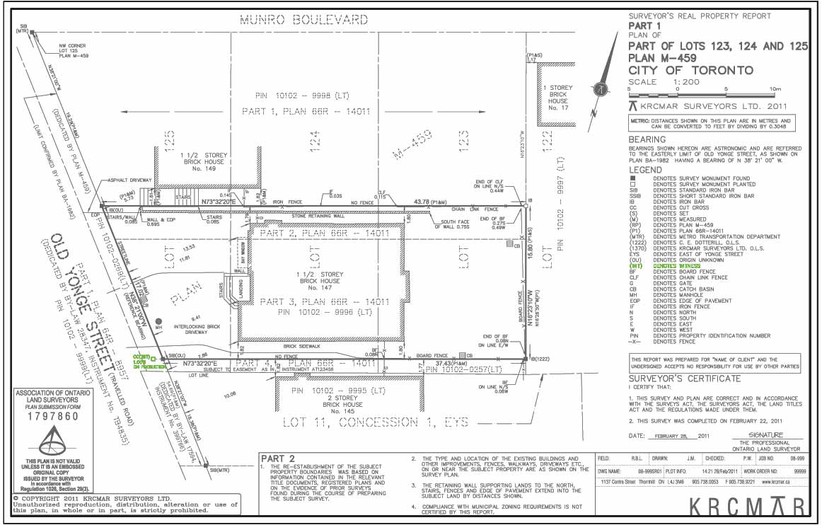
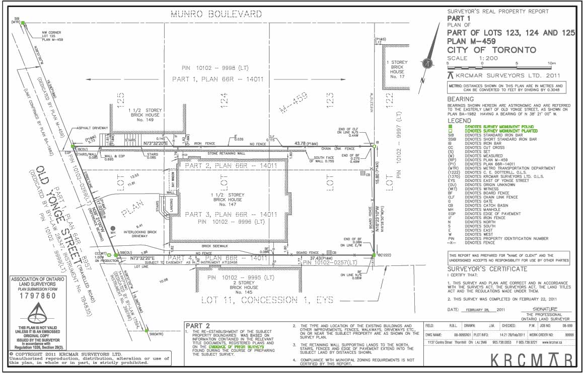
WIT - Offset Monument
Denotes legal monument set by surveyor to "witness" a corner, angle, curve or bend where the true location is obstucted.
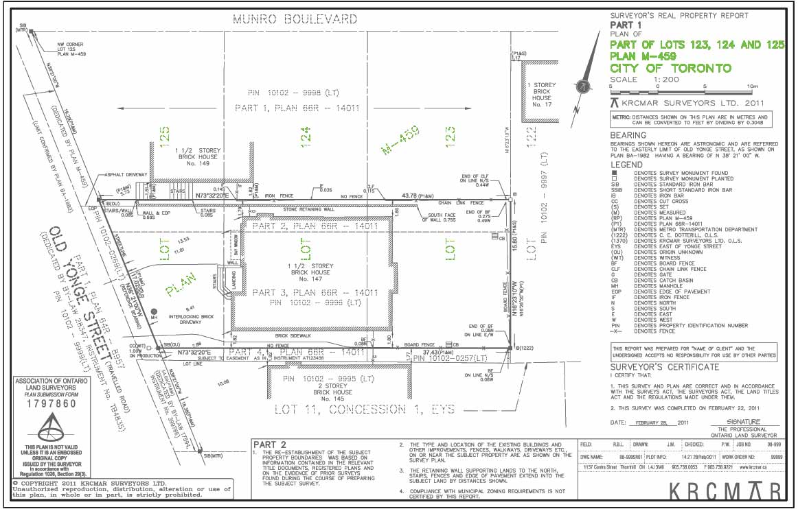
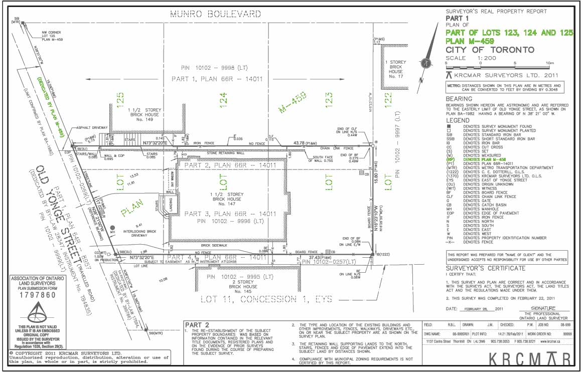
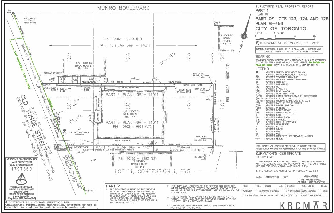
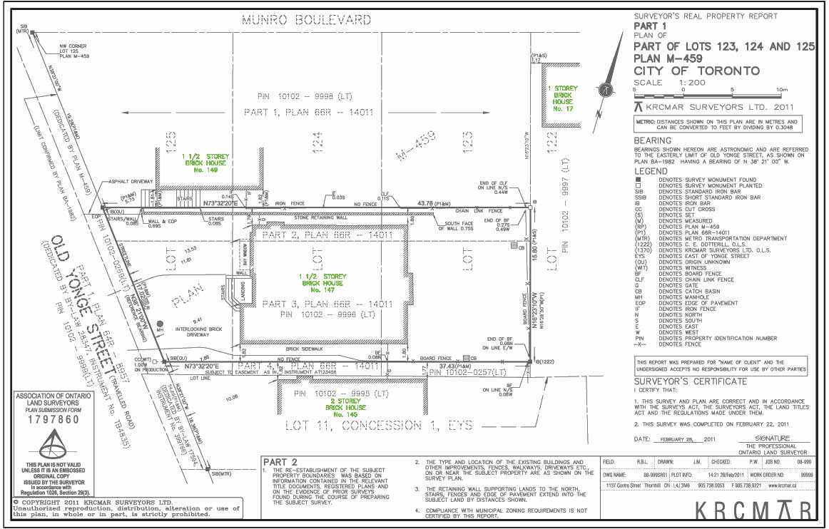
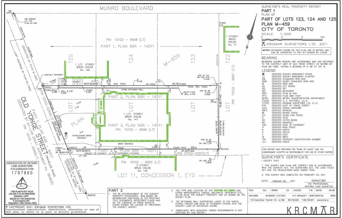
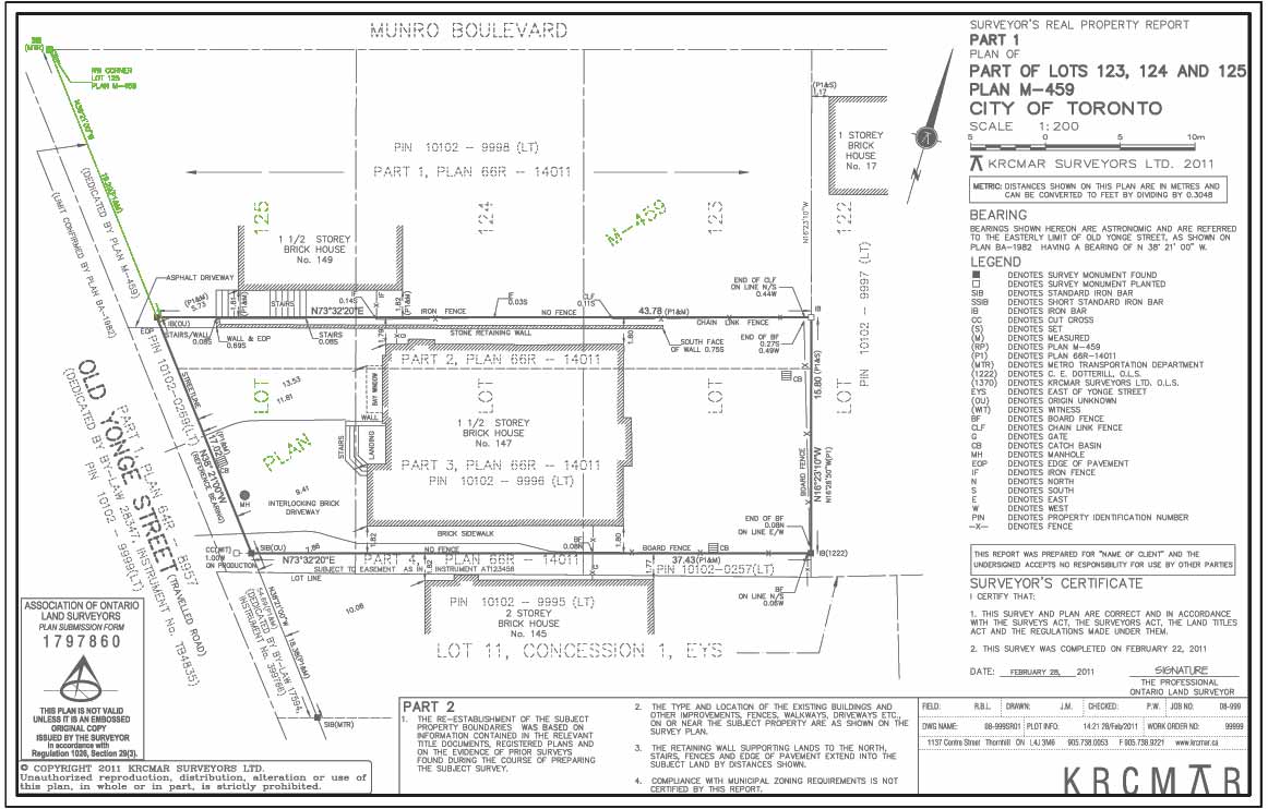
Part of Lots
The property being surveyed is part of the Summary listing of underlying Lots shown on the subdivision plan.
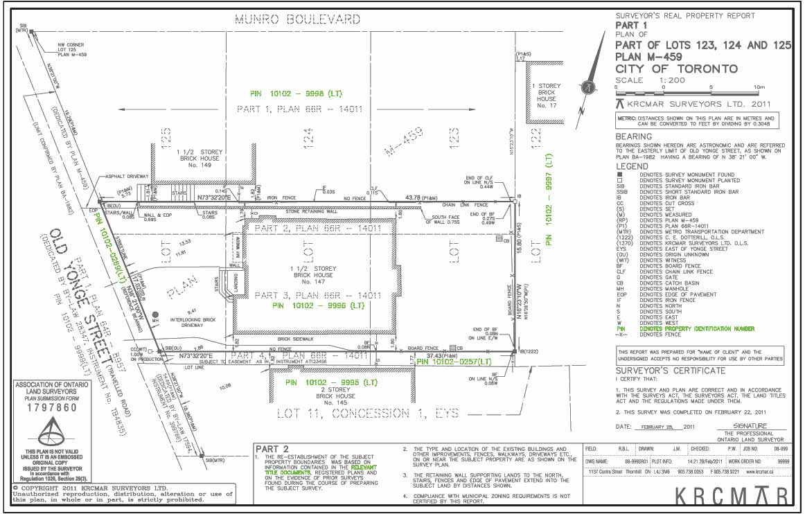
PIN - Property Identification Number
The "PIN", is a unique 9-digit identifier assigned by the land registry office to uniquely identify each property in Ontario.
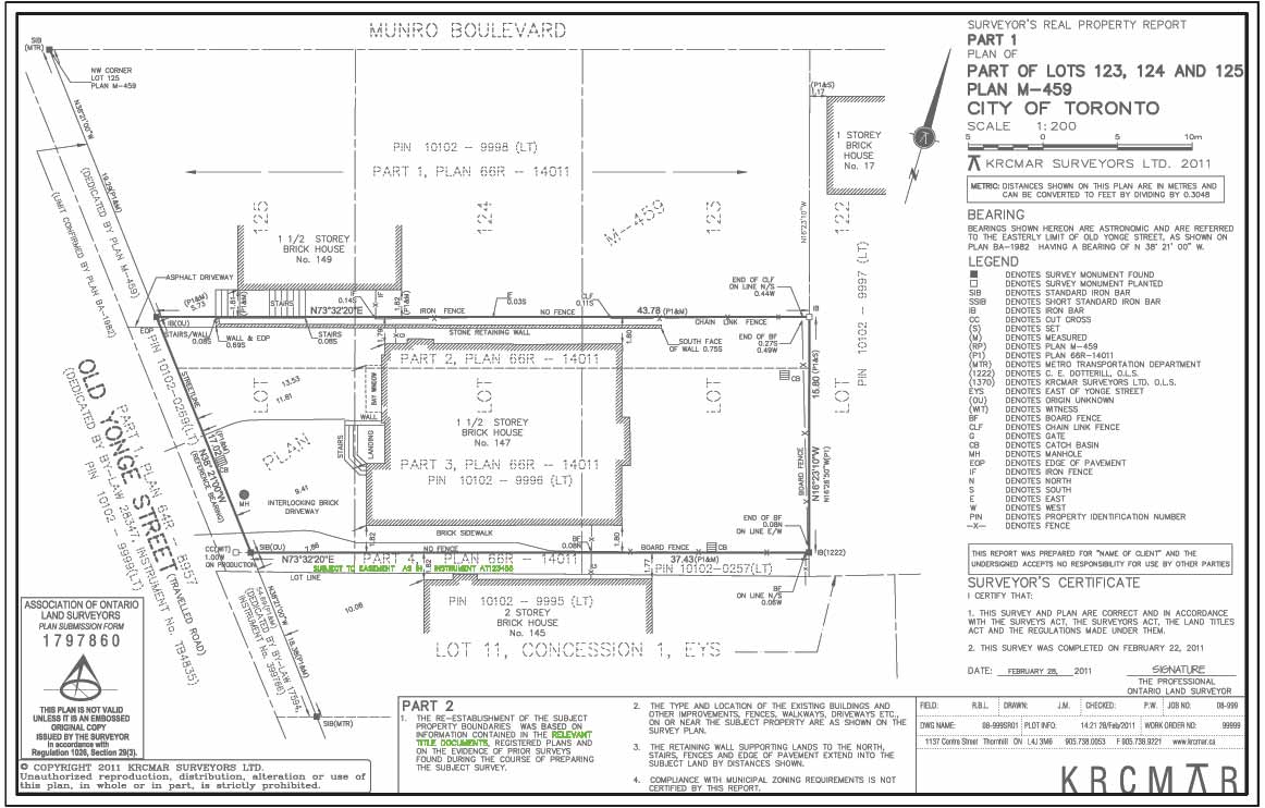
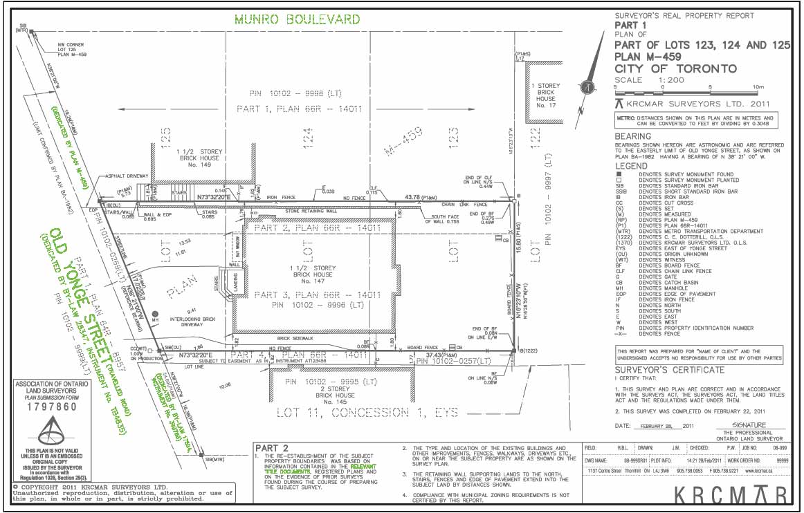
Easement over the Land
Identifies existence of an easement and provides its location on the survey plan.
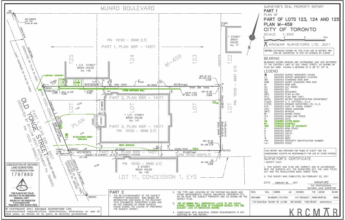
Ground Features
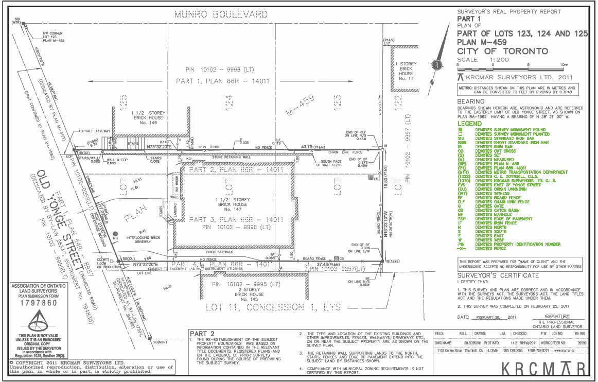
Denotes physical site features potentially indicating easements, neighbour encroachments or other problems such as catch basin (CB); manhole (MH).; edge of pavement (EOP)
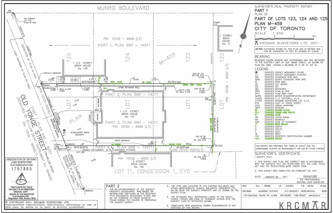
Fences
Details of permieter fencing and enclosures at the time of field survey. specifically board fence (BF); chain link fence (CLF); gate (G); iron fence (IF); no fence
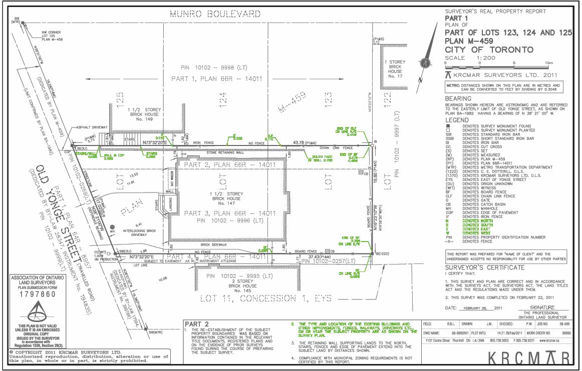
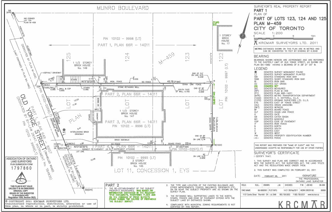
Reports Parts 1 and 2
An SRPR must have two components. Part 1 is the plan and the written report set out in Part 2.
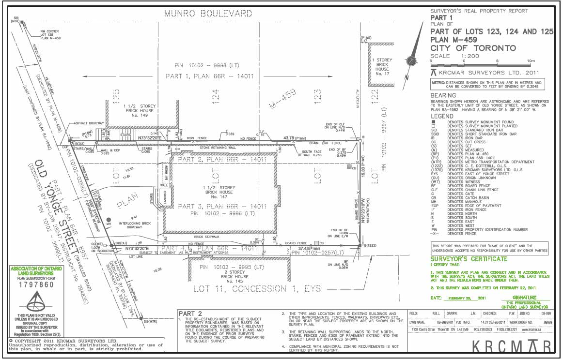
Plan Submission Form
The Association of Ontario Land Surveyors can review any plan for adherence to standards.

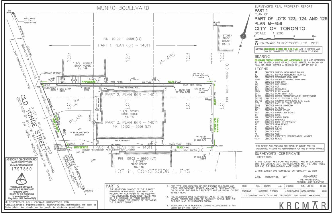
Reference Bearing
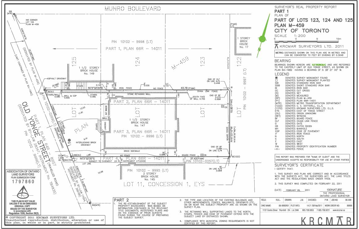
This plan is oriented to north by a bearing angle derived from a line defined by survey monuments.
How To Read a Property Survey: Why is it important?
No matter if you are a homeowner or a professional who deals with land, understanding how to read a survey plan is an essential skill for anyone involved in research, property management, or land development.
By following the content outlined in this blog post, you can effectively analyze and interpret survey plans with ease.
Remember to identify key elements, determine scale, read boundary lines and labels, and analyze the information for accuracy. By mastering these techniques, you'll be equipped to make informed decisions based on the information provided in survey plans, leading to better outcomes for your projects and endeavors.
Protect Your Boundaries Inc. is a licensed member of the Association of Ontario Land Surveyors, and is entitled to provide cadastral surveying services to the public of the Province of Ontario in accordance with the provisions of the Surveyors Act R.S.O. 1990, Chapter S29.